Thursday, July 15, 2010

Hrad Hukvaldy

Fortification: Hukvaldy Castle
Location: Hukvaldy, Czech Republic
Built: 13th century (Approximately 1240)
 
Remaining original structures: See information on detailed map, below. A fire in 1762 destroyed the castle, which was already in disrepair, but it has since been renovated.

Hukvaldy is the third largest castle in the Czech Republic and it is quite impressive (so this will be a long tour- please get your tea and get cozy). The castle, like the Acropolis I saw earlier, lies along the Amber Road.

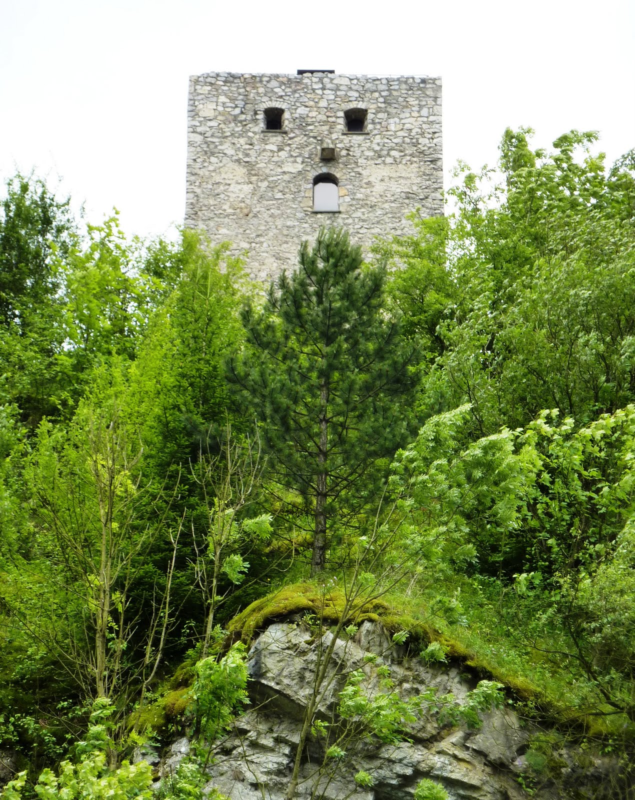
Hukvaldy is set on the top of a hill and surrounded by lovely parkland with many old trees.


And some old, old trees, which are wisely not cleared away since they provide a niche for wildlife.


Climbing up the winding trail, the hill became steeper and steeper. I'm not in shape for hills so I took lots of pics as an excuse to stop and catch my breath.


 And steeper:


 And steeper, but now I'm near the top, hurrah!


And finally, huffing and puffing despite the stops, I reached the front/main gate:


If you'll forgive me one more scenery shot (from ground level), this is the view from a broad overlook to the left of the gate:


Near the front gate is an overhead depiction of the castle. Writing on the sign mentioned that the castle had never been taken. Still recovering from the climb, I thought "No S***!" ;)


I was fortunate enough to get two maps in English. First, the simpler one:


I have no idea where 9 is. I swear I found it while standing before the original map, after some hunting... I can tell you that the double square bit above IV is a well.

And now, just about everything you'd wish to know about the castle design:


Some of the translation needed a little editing, but not bad at all. It's a lovely map, and I'm glad they were selling it in English.

Please note North on that map (see left column)

I'm going to suggest you orient yourself with the complex map, and open the simple map in a new window for reference as we move through the tour.

So, finally, stepping through the first gate, we see the second gate and the bastion:


(Try as I might to keep tourists out of my shots, or at least have them in the shadows, sometimes it just doesn't happen.)

To the right:


We have the Kulatina fortification which was built around 1486, but never completed.


Next we head through the second gate and I stepped off the path for this shot:


Turning around, back to the second gate, we see the locals coming by:


There was a presentation and tour later in the day, which was quite good, but in Czech, of course. I understood a little though.

So the next shot is mostly to give you an idea of terrain. To the left, the hill is pretty steep, but the path goes forward and around and at a steady climb to the Kulatina fortification, which we will get to briefly at the end of the tour.


Continuing along the outer bailey (between the second and third gate), we have a section of the north wall:


Getting back on the main path, we have the third gate and more locals:


Doing a 180 and shooting back across the outer bailey we see the church and more tourists (I wait and wait for them to clear out, but they never do so all at once ;) ).


Here is an interior shot of the church:


Between the third and fourth gates is a comparatively small area. The south side was where the dogs were kept:


Behind me (I didn't upload the photo) is a similar (larger) ditch that served as the cemetery, and some more fortifications. The cemetery was small and after they buried a group of people and put dirt over them, they buried more on top of them.


Passing through the fourth gate we have the fifth gate soon after, but this is the bastion to the left of it:


And looking left, we have a broader ditch:


If you look almost center, in the above picture, there is a little alcove (not dead center, where there's a door, but to the left of that). That's where I stood for the following video which shows the layout a bit better. You can see the bridge, which was once wooden so it could be burnt when invaders came.


Passing through the fifth gate, we are greeted with this site:


That's the palace to the left and the white tower. This tower served as a kitchen and had a cellar for wine and food. It is plastered to show how the entire castle once looked (aside from the missing roof of course!). That's one thing I learned on this trip: Plaster doesn't last. Really thick walls do pretty well, unless demolished.


Heading to the back, through a relatively narrow passage (not pictured) and around the old palace, we have this:


That picture is facing northeast.


In the same area, we have the well, now covered:


It was built in 1581 and 150 or 170m deep and called bottomless. It had a mechanism to draw water that was destroyed in a fire and not rebuilt.

Looking back to the palace, we have this shot:


And exploring further we have:

(That's the well on the right)

The stairs lead to this lovely view:


So, heading back out of this area, with the palace just visible on the right:


We have the fifth gate with the palace on the right, as seen from inside the white tower:


As noted on the large map, this 6th gate into the palace is only for pedestrians.


I have a nice video of the inner courtyard, but it won't upload, so here are some photos, starting with the southeast wall:

The stairs in the corner lead into the white tower and a large room. As you can see, the windows were quite large here.


This shot is looking across the courtyard from the circular tower.


Looking southwest from one of the castle rooms:


And south:


The next picture is taken from the top of the circular tower (still in the old castle), and shows the rest of Hukvaldy sprawling out down the hill. The entire castle is 800 meters long.

If you look closely down the center (a hair left of center) between the paired tall trees, you may be able to make out the Kulatina fortification from the start of the tour. It is hard to tell at this image size, but you can see the level stretch of wall.

Next, some interior shots of the tower:

These are supports for the old floor. Now there's a staircase that wraps around.


And an interior shot of the north side of the castle, where I could look but not walk (this is near the scaffolding where they are doing repairs):


That's just a small section and it is pretty massive, no?


Heading back out and down the hill, we have the third gate again (I do love arches):


Lastly, the Kulatina fortification. It is now a concert hall inside, so I will skip the interior shot and leave you with another overview of Hukvaldy.

That's the fourth gate, top center. The third gate is hidden in the trees below it. The circular tower can just be seen to the left of the fourth gate.

I hope you enjoyed this tour. For further pictures, you can see the fotogalerie at the official site. There is information available there about the castle, in English.

Thursday, July 8, 2010

A day at the Archeopark, part III

Hello!

Please find part I here. You can also pull up the map there. Part II is here.

The Acropolis was not only important for defense, but all ceremonies occurred here. Weddings, funerals, and important gatherings. The guide did not mention rituals (or she did and it didn't get translated to me!), but there were many drawings of people sitting semicircle around a person and a tree. I should probably google on slavic rituals and then hit the library. :)


Only the highest ranked people lived within the acropolis. Here are two of the three housing types:


I did not find out the distinction between the housing types, but the roofs were made with straw or reed. The lipa or linen tree was used as well in construction. The lipa leaf is the symbol of the Slavics.

Wiebrza was soaked and then used as rope.


Next we have the inside of the first house:


Note that the floors were actually dug out to 1.5m deep, and in this house the floor is only about 0.5m deep, though it is hard to tell. The subterranean section kept the house cool in the summer and hot in the winter. To the left, cut off from the photo, is the bed with skins on it.

Next is the interior of another house:


Note both houses have fire rings. There were no chimneys and smoke worked through the roofs.

I didn't have a chance to photograph the third house well. You can see it clearly in part II, however, in at least two different photos.


Next we have the kilns. This was used to melt and process iron.


This was one type of oven, for making flat bread:


And this was used to grind wheat into flour by turning the top part:


This then, is the long house. Unfortunately the guide could not say what happened within the large building.


You'll note some metal tools on the wall, along with various shields and skins. I'm not sure if that stick was for the chief or the religious leader or ? (So many questions, so little time on the tour.)


Next we have a writing tab, with the Russian-like alphabet shown on the card. The writing piece was used to inscribe and also to smooth over the tablet so something else could be written.


A few tablets listing part of the Slavic Pantheon. I have not had this translated yet. Anyone interested, leave a comment and I'll let you know when I find out.


Perun and Veles are listed on this set, and they are my favorite gods so far :)


Next, a showcase of all the natural dyes. The tags list their source, but again- not enough time to have it all translated to me. Indigo was rare and very expensive. If I recall correctly, it was only worn by people of status. The dress on the wall depicts typical woman's clothing.

This is typical men's wear:


And these are typical tools:


They had shackles for prisoners or possibly for slaves. The scissors were very sharp, and the tour guide demonstrated on a kid's hair.When a boy was 6 years old, he received his first hair cut. Afterwards he was no longer his mother's responsibility to raise, but his fathers.


Next, more shields!


I wish I had a close up of the bows and arrows...

Thus ends our tour. I managed to get a nice shot of the wall on the way out:


And one last shot of the bridge:


So, clearly there is still a lot for me to learn here. It was a nice glimpse into early medieval life, however, and I really enjoyed touring the site.


fin.

Wednesday, July 7, 2010

Happy castle is happy?


"Oh hell, that's a big enough army in the valley."


Sorry, couldn't resist a little silly. For those not familiar with the pop culture reference in the title, google 'happy chair is happy'


Today I went to Hrad (Castle) Strečno and enjoyed something a little different. I'll have plenty to show you folks after I finish the last Archeopark post and then Hrad Hukvaldy.

Meanwhile, for anyone interested, here is a neat virtual tour of Hrad Strečno at night. Note that the pictures pan every which way! Nice. My upcoming post will pale by comparison, but I got some nice video at least :)

A day at the Archeopark, part II

Hello!

Please find part I here. You can also pull up the map there. I now plan on splitting this post into three parts. Part II will also be a more overview and orientation post, and part III will finally delve into the culture and lodging in more depth.


Continuing where we left off, crossing the bridge to the Acropolis, you can see the palisades in detail now.

(Okay, I'm cheating, this was taken from the access road with a zoom lens, just downhill from the bridge. Thus the palisades look properly imposing.)


Entering the acropolis then, we see a few houses on the north end.

It is important to note that during re-creating the fortress, they only built three houses; one of each type they found here. There were originally far more houses. I also learned that they have only uncovered about 20% of the area. Because of this, they have not actually found a longhouse, but they know it should be here based on findings from similar fortresses in the area. More on the housing in part III.


So, turning 180 and facing the gate through which we entered, we can see the main part of the defenses.

On the right, at the edge of the photo, you can see a rising hill of earth. This is untouched ground, left for future archeologists and technology to explore. I plan on returning to the Archeopark every time I return to Eastern Europe (hopefully every year) and seeing what else has been discovered.


Next, a quick peak at the west wall:

Hidden behind the ramparts is the side gate, at the top of the access road. The Archeopark uses this as an exit for the tourists, which is a shame since I wanted to go through the main gate again ;)


Moving on, if you would join me on the east wall:


We can look down and see the beautiful construction.


Yes, those are wood logs along the floor, cut in half, and alternating between flat and rounded sides. Beautiful, no?

In addition to this solid construction, the space under the floor was completely filled with stones. That way, when something solid struck the wall, it would not easily collapse. Even so, I would not want to be one of the people charged with moving all those stones!


Next, another look across the Acropolis, this time from the wall.


Turning to the East now, we have an excellent view of the valley:


And we can walk along the wall and look south, over the first Předhradí (and down at the access road):


Lastly, a view from the wall down to the front gate:


Thus concludes part II. I hope you enjoyed the walk-through. Part III will be up soon.

Tuesday, July 6, 2010

A short update on Castle Hill.

First post here.

I went back to Castle Hill, in the rain, to find those stables and a little bit of information. Well, the stables and the palace are now all shops and whatnots. The outside still looks lovely, but I've no idea if it's a replica, partial replica, or what.

That tower by the false ruins, with the little wood roof over the base? That is the Tower of Ultimate/Final Defense. Shame they didn't rebuild it properly.

Lastly, here is the Piast Tower as seen from town.

Monday, July 5, 2010

Random post is random. (But with castles!)

Why hello,

Since Castle Hill I have visited the Archeopark, site of an early medieval age Akropol, and also Hukvaldy, the third oldest castle in Czech. I am working on the blog posts, but these things take time :)

Meanwhile, I have a few photos to entertain with.

First, by request: More haystacks!


A nifty wagon:


And now, a ton of Czech castles. Well, okay, a few- I'll try and get the full poster later, and in better quality. This is but a small sample. Most of the dates on these are the dates they were reconstructed. If there are two dates, the earlier may be the year it was reconstructed to; ie- how it looked in 1613 or w/e. Note there are some repeats.

A day at the Archeopark, Chotěbuz-Podobora. Part I

Fortification: Akropole of 'Old Cieszyn'
Location: Chotěbuz-Podobora, Czech
Built: 8th to 11th century

I am no longer jealous of the French and their authentically authentic castle (see earlier post), as I have been to an authentically authentic fortress that is also in the process of being completed.

The Akropole, or Akropol, or Acropolis, or if you will--Citadel--at Chotěbuz-Podobora is now an Archeopark. It is unique within Czech as it is an outdoor museum and rebuilt on the original site.


The archeological discovery was made in 1978 and reconstruction began only recently. The park will be finished later this year, and there is little available about it in English at this time. (If anyone finds a source, please let me know!) Because of this, I hope to provide a very detailed blog post, in two parts, on the history and culture.


You may visit http://www.muzeumct.cz/pobocky/pobocky/chotebuz.php for more photos or if you read in Czech, but the site is not currently available in other languages.

In the 8th century an important trading route, the Amber Road, ran from the Adriatic Sea to the Baltic Sea (more here). The Acropolis was an important stopping point on the route and the Slavics here conducted a great deal of trade.

In 1155, the site was first mentioned in writing, and was referred to as Old Cieszyn. During the 10th and 11th century, however, people had moved from ‘Old Cieszyn,’ and none lived there by the 12th century. It is believed these people built Castle Hill, the construction of which began in the 10th century. This is likely due to the destruction of the stronghold at ‘Old Cieszyn’.

Going back to the 8th to 4th century B.C., during the late Bronze age and the Halstadt Period, pagan people had a settlement here. An unfortified or minimally enclosed settlement gradually became fortified. But during the 5th century B.C., the early settlement was conquered and burnt down by people who set fire and ran. At an excavation site in the first Předhradí or bailey, they found the burnt bones of the people who hid there during the attack. They also found broken jewelery and the remains of a cow that was pregnant. The fire destroyed the stable and caused the roof to collapse on the cow. This helped preserve her and her fetus, the later of which was kept moist in the uterus.

Then there was nothing on this opportune hill for twelve centuries.


So, to begin our tour, I once again found myself at the bottom of the hill, just in time for a tour group that was heading out. Mind, the tour was in Czech mostly, but it all worked out in the end, particularly when the tour guide took an extra 1/2 hour to go over things again with me and answer questions :)

So, please excuse the poor photo quality, but here we are at the base of the hill:


As far as I could tell, the stairs were the only unauthentic item. Obviously not useful for carts and here is the one place I saw metal nails in use.


***


Now here we are, at the top of the stairs, looking up at the corner of the Acropolis, or 'Highest City.'

Let me take you back to the map for orientation and explanation. Again, please bear with me through the technical part and please open the map image in a new window for future reference. (Though perhaps not as required at this fortification). This is an overview of the fortress, approximately as it looked around the 11th century, and as it looks now.


So, clockwise from the top: Acropolis. Long House. Palisade. Slavic fort, tower, and entrance gate. Bridge. Little bridge at entrance. 1st and 2nd Předhradí -> Literally 'under castle' (Podgród in Polish and Bailey in English). Next area of development (the 2nd Předhradí is not completed) (This is the area at the bottom- the 2nd Předhradí). Access road. Original ground (to be excavated later). House replicas. If that's unclear, someone yell at me in the comments, or keep reading. :)

The fortress covered an area 400m long by 110 wide.

It is interesting to note that the Olza River once ran past the base of the hill, where the entrance and little bridge now lies. The Olza ran here until the 18th century, when flooding created a new corridor for the river. It now runs 500-700 meters further east, past Castle Hill in Cieszyn. A small stream runs there now, along the road.


Climbing up the access road and hanging a left at the top, we reach the first Předhradí.


This clay kiln, sitting in the first Předhradí, was used to bake bread. The tour guide mentioned that they made bread in it once and it turned out quite nice. :) I will be covering kilns more in my second post.


The next shot is looking almost straight across. Please ignore the metal structure, which may have been for the archeologists.


You can see the pit and the mound of dirt from the excavations. This is where they found the preserved cow I mentioned earlier. At the back of the pit, you see a steep hill. This wraps around to behind where I was standing and is part of the acropolis' defenses. Next we walked back behind that metal framework, and downhill into the trees-


This ditch was dug out and the earth raised around the first Předhradí. If I recall correctly, the difference in height is 8 meters. To my left is the second Předhradí, which is further downhill. We didn't go there on the tour as it's not complete, but wheat, oats, and other grains were grown there.

So, crossing the 1st Předhradí again and heading north, we arrive at the acropolis:


The bridge was made entirely without nails, and you can see the joinery and wood peg (I'm sure it has a technical English word associated with it- I saw this once on TV but forgot!) used during construction.


Nice, no? The fortress is also made without metal nails.


Lastly, an aerial shot of the reconstructed fortress:


This concludes part I of our tour. As soon as I can, I will continue our tour inside the acropolis and tell you more about the people who lived there.